Llangynidr Mountain
Llangynidr Mountain is my favourite training road.
It’s where I like to do intervals on the bike and it’s also where I like to go if I’ve only got an hour to indulge myself. Its literally around the corner from home.
The climb is 5.9km in length with an average gradient of 6.8% and a vertical ascent of 399m, reaching 522m in altitude. By UK standards that makes it a pretty long climb but it’s really steady and never gets much beyond 8% so you can get into a good rhythm.
Llangynidr sits in the Usk valley and so the climb takes you from the lush green pastures of the lowland and up onto the exposed moorland above 1000 feet. It’s this contrast in landscape between low and high that I particularly love about this climb.
It begins just outside the village, taking a right turn signed towards Beaufort. The first few hundred meters are pretty punchy but don’t worry, it soon settles down into a steady gradient where you can establish your rhythm as you pass a few farms and the road is flanked by hedgerows on either side. This first couple of km is all about settling in. There are no great views to distract you, but just wait, as these are soon to reveal themselves.
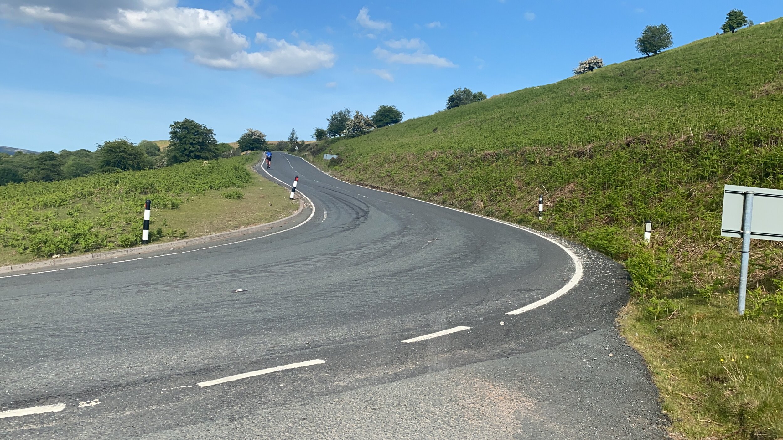
Once over the cattle grid, it feels like you are out of the valley and onto the high ground. The hedgerows disappear, bracken and rocks take over and sheep become your companions. The first switchback is just ahead and on this corner you can see the vast expanse of high Beacons stretching out in front of you where many a movie has been shot. Around the switchback you go and suddenly you can see back down into the Usk valley and over towards Llangorse Lake. This section between the switchbacks often has a tailwind so enjoy the extra momentum despite the slightly steeper gradient around 8%.
Once around the 2nd switchback it looks like it’s the summit ahead, but it’s not, and once over this crest you’ll see the magnitude of the climbing that’s still to be done, so stay in the moment and keep making progress. You also get some big vistas to the west, with Sugar Loaf sitting proudly above Abergavenny further down the Usk and The Tumble lies opposite on the southside of the river. Take all this in as you enjoy the respite of a short descent that takes you past a limestone quarry before the road sweeps right and then left to set up the final sting. This last section always feels the steepest with the wind at its strongest so make sure you keep something back for this final push.
By the time you reach the top you will have climbed by 399m or 1316ft. Its wild up on top and feels really remote with magnificent 360 degree views and often Brecon ponies for company. I love it up there. The road now continues south by rolling along the moorland plateau before crossing the Heads of The Valleys road and dipping down into the old industrial heart of South Wales.
If you enjoy descents then you may choose to return down the final section and then take a right towards Crickhowell and Llangattock. This road makes you smile. It’s a really smooth surface, with long sweeping bends, affording great visibility. Just be careful towards the bottom when the canal bridge can emerge very quickly around a corner. This is a proper hump back bridge so take off sufficient speed and then you are into the village so slow right down and head for the river. From here you can go right towards The Tumble, head over the bridge for coffee in Crickhowell or go left and tackle the climb again!!